Semi-Autonomous In-Flight Wireless Directed Energy Transmission & Mission Plan Optimization

Strike Labs has worked hand-in-hand with Forcyte to support the development of semi-autonomous in-flight wireless directed energy transmission and mission plan optimization tool. Via the FedTech program, Forcyte completed a tech transfer from the Naval Surface Warfare Center - Crane Division for technology that calculates the efficiency of transmitting power wirelessly using radio waves.
Wireless power can be transmitted through the air using radio frequencies, captured by a receiver, and converted into electricity to power batteries. This proven technology has not been mastered. And yet today, if you look around, you will see this technology is starting to roll out. For example, smartphones, and some electric cars can be charged wirelessly.
As time goes on, we expect the efficiency of transmission will grow exponentially, allowing the ability to a) charge more things, b) with less power transmitted, and c) sent a longer distance.
The US Air Force wants to beam solar power to Earth from space
Strike Labs LLC team is working on the systems integration, algorithm, and the user interface with the following capabilities:
Algorithm
Calculate efficiency of power transmission based on power output of the transmitter, frequency, range of devices, weather data, aperture area of the transmitter and receiver, to include the what-if derivatives of this algorithm.
Production
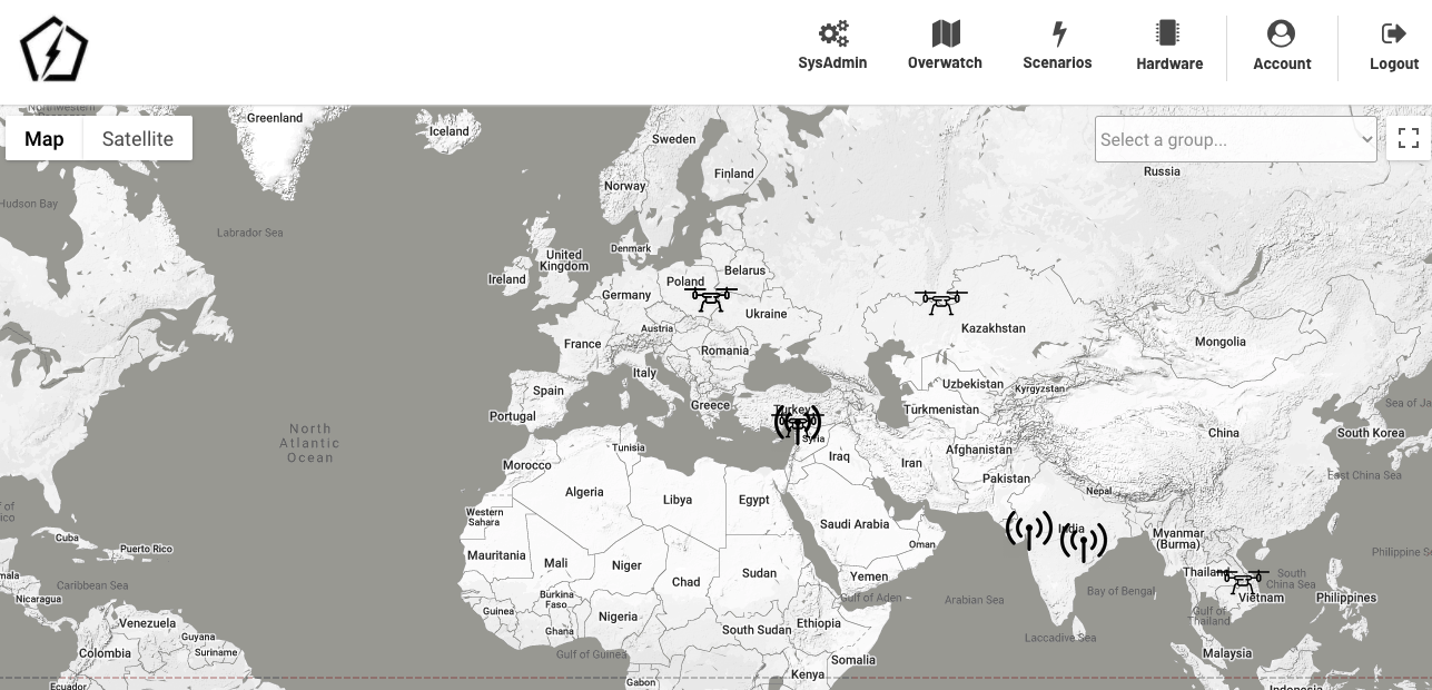
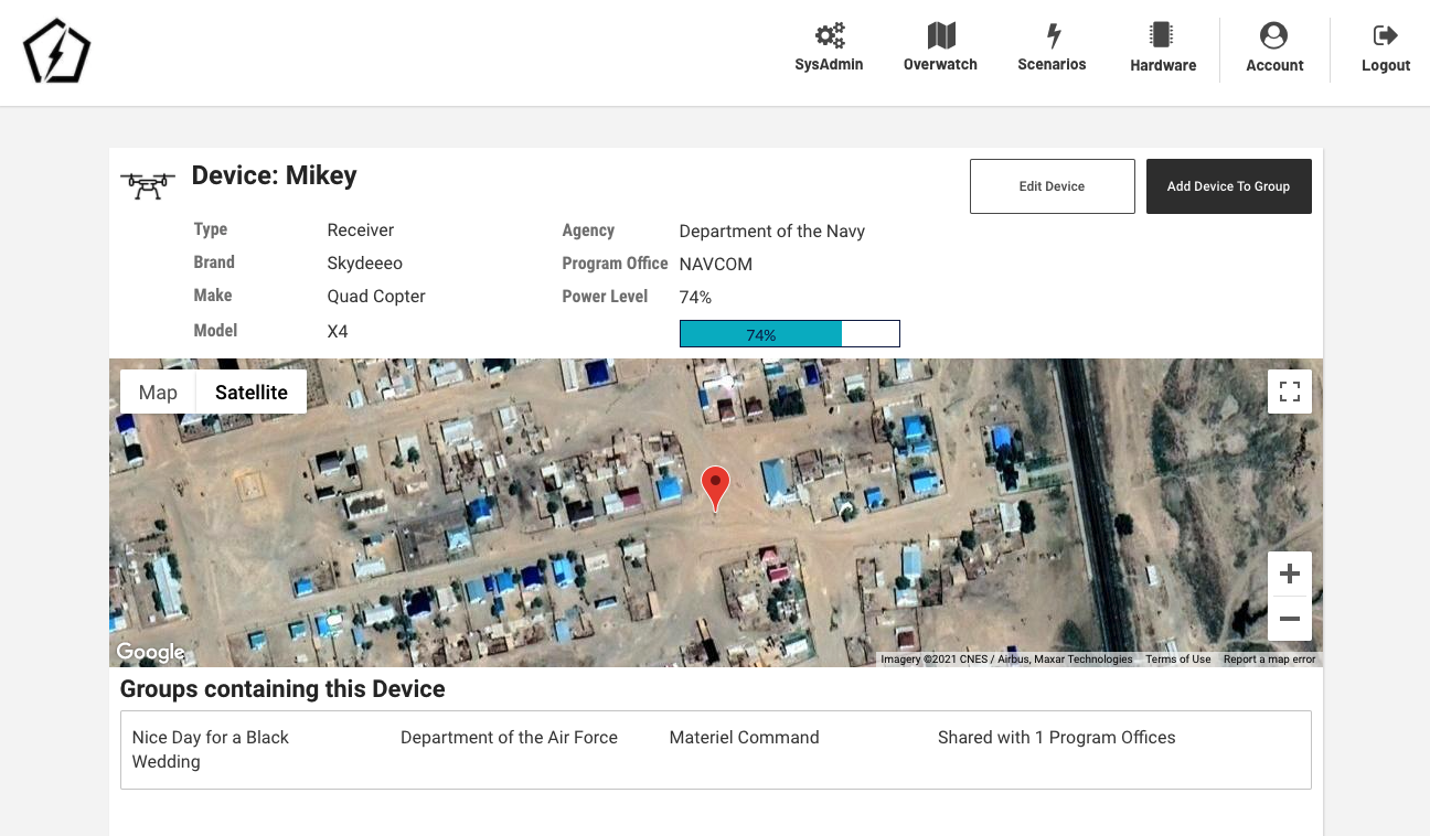
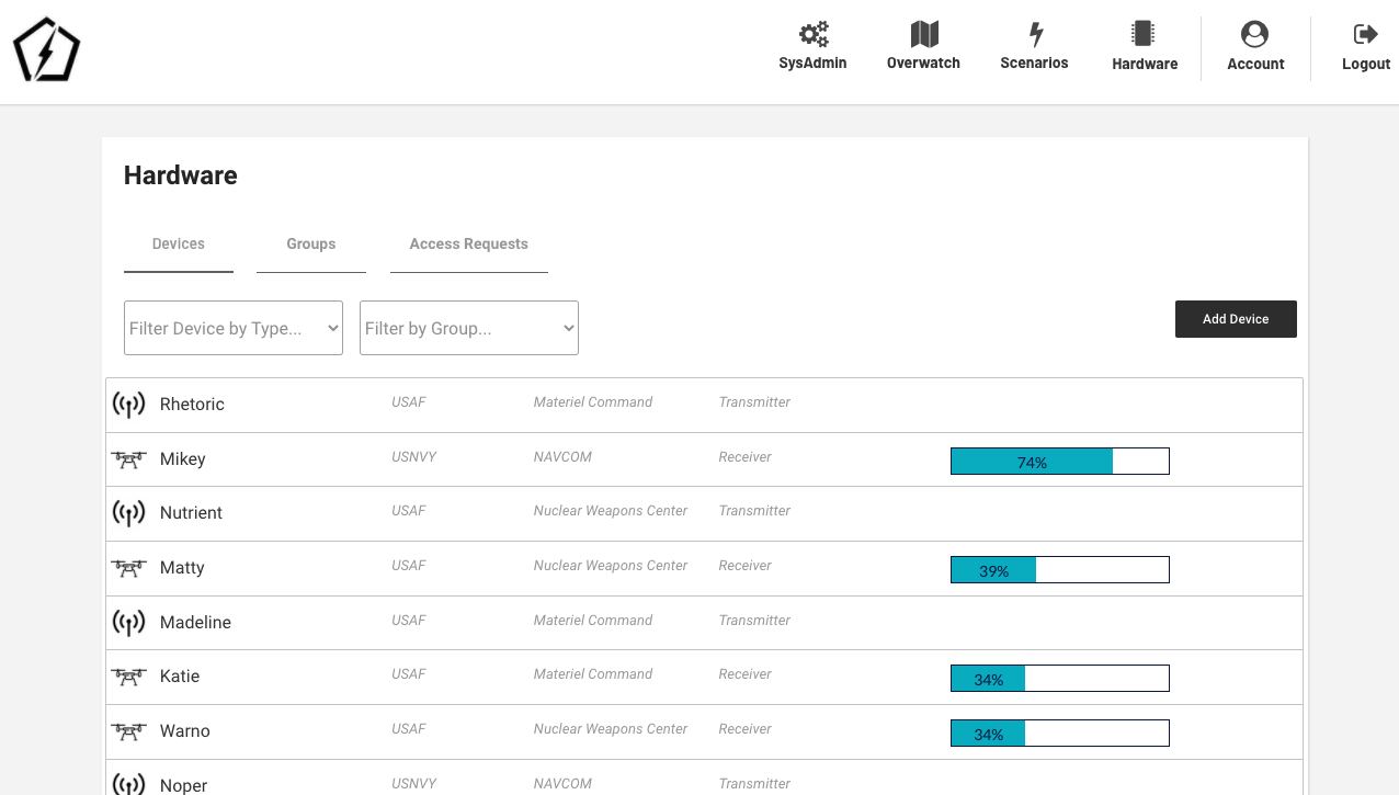
Track the location and power measurements of drones and other power receivers. Power drones in flight, and perhaps break the record for keeping a drone a-flight.
Optimization
Optimize mission planning with semi-autonomous drones that automatically charge in-flight and hand off power during missions.
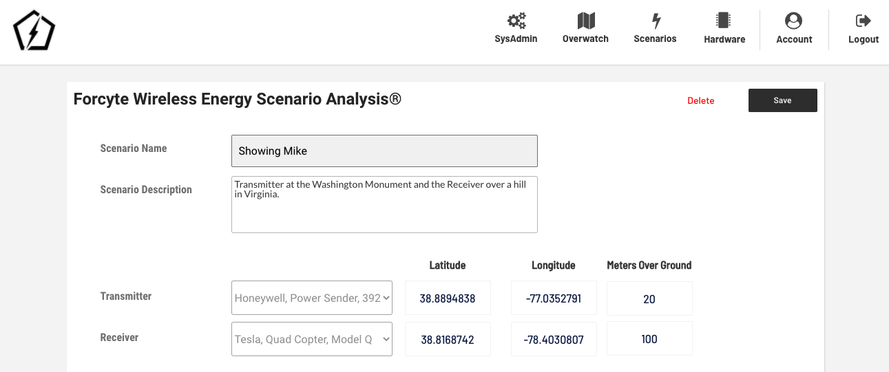
Height is not Altitude
Moreover, height over ground is not altitude. A transmitter at a 5 m height could be near the coast, and a receiver at a 73 m height could be over a hill, so the vertical delta is not simply ABS|73-5|. To calculate the vertical difference differential, we retrieved the exact elevation at their specific locations, and added the height over the ground for both devices to find their true altitude.

https://mapscaping.com/blogs/geo-candy/what-is-the-difference-between-elevation-relief-and-altitude
Receiver
Elevation 100m - retrieved from API based on latitude and longitude coordinates of device
Height 73m
Altitude = 100 + 73 or 173m (This formula may need to be adjusted when we are calculate vertical distances for underwater devices.)
Transmitter
Elevation 21m
Height 5m
Altitude 26m
Vertical Distance = absolute value of (26-173) or 147.
With vertical distance calculated, along with the horizontal distance between two coordinates based on some of our previous work, add in a little Pythagorean Theorem and we can get the straight line distance between two coordinates and two different altitudes. The tool can see the elevation along the path between a transponder and a receiver to see if any objects are in the way.
Power Efficiency
Aside from the distance calculator, the work includes re-working the algorithms created by the NSWF Crane Scientists to calculate power efficiency with variables such as the Power and Radio Wave Frequency of the Transmitter:
Aperture Area of Transmitter and Receiver.
Transmitter to Receiver Distance.
Weather, such as the Atmospheric Pressure and Humidity.
Plus, device specifications like Battery Charging Rate, Power Output Rate, etc.
Feel free to contact us or Forcyte.
Application Screenshots